Making Parliament the beating heart of democracy
21 September 2018
Cogitate simul et pariter Orbem
8 October 2018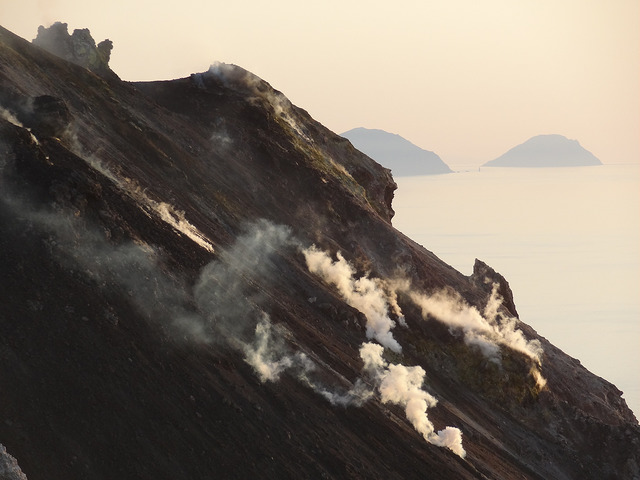
by Giacomo Parrinello
Assistant Professor at the Center for History
The geography of tectonic faults exposes some regions of the world to earthquakes and volcanic activity. These natural phenomena are part of the history of these territories, but their influence is underestimated.
From Messina to Belice: Human losses and habitat destruction
![Luca Comerio [Public domain], via Wikimedia Commons. Crédits : domaine public](https://www.sciencespo.fr/research/cogito/wp-content/uploads/2018/09/566px-Comerio_Luca_1878-1940_-_Vittime_del_terremoto_di_Messina_dicembre_1908.jpg "Luca Comerio [Public domain], via Wikimedia Commons. Crédits : domaine public")
Located at the intersection of the two major tectonic plates of Eurasia and Africa, Sicily and its archipelagos are home to both frequent and spectacular eruptive phenomena, like those of Stromboli and Etna, as well as strong earthquakes, a number of which have been particularly destructive. The 20th century saw two major cases: the Messina earthquake in 1908 and that of the Belice river valley in 1968.
Messina, which was a mid-size port city at the time, was surprised by the earthquake of 28 December 1908 in the early hours of the morning. Over 80% of the city’s buildings collapsed, causing the deaths of at least 30,000 people. In the Belice valley, an agricultural region of Sicily consisting of scattered villages and towns, a series of minor earthquakes on 14 January 1968 put the population on alert, thus saving most people from the next day’s major earthquake. The destruction was just as intense, however: over 14 villages were destroyed and over 100,000 individuals ended up homeless.
Major reconfigurations
These earthquakes were followed by transformative reconstructions that profoundly reshaped urban structures and territories. Messina was rebuilt in line with the era’s models of urban modernization and sanitation. Low, spaced-out houses, straight boulevards, and modern infrastructure emerged from the ruins of 1908, creating a city that bore no resemblance to the one that was destroyed by the earthquake. In Belice, the 14 hardest-hit villages were rebuilt according to modernist plans and, in some cases, on sites located far away from the original locations. These two reconstructions exemplify two moments in contemporary Italian and European urban development: the renewal of ancient cities between the 19th and 20th centuries, and land use planning in the decades after World War II. However, they are also exceptional cases, because the scale and ambition of the revival of these territories have no equivalent. To what extent did the earthquakes influence the transformation of these two territories?
 Tracing a history in the long run

This question was at the heart of my book Fault Lines. Earthquakes and Urbanism in Modern Italy(2015, Berghahn Books). Answering it required going beyond an analysis of what happened after the earthquakes. Everything seemed new in the aftermath of the catastrophe, but this was not always the case. An approach both simple and rigorous was needed from the outset: to analyze the pre- and post-earthquake periods over several decades. What transformations had occurred before the earthquakes? What trajectories could be identified? Answering these questions enabled a comparison of preexisting trajectories with transformations in the aftermath, and a better understanding of the earthquake’s influence, by distinguishing it from other factors.
Important transformations that go beyond cities
Of course, there was no shortage of novelties. After all, urban environments emerged from the ruins. But the earthquakes’ influence also played out in other, less obvious dimensions. The introduction of anti-earthquake norms in Messina is an example. The city had long been known to be at-risk for earthquakes, and several earthquakes smaller than that of 1908 had occurred over the preceding three decades. But none of these earthquakes had resulted in challenges to the unregulated urban growth policy, or to the absence of adequate building codes. But after 1908 these considerations became central elements in all reconstruction projects. New earthquake-proof urbanism and engineering codes imposed lower urban density than before, and had a notable consequence: an impressive horizontal expansion of the city into surrounding agricultural areas.
Before the earthquakes

While this shows how the earthquake changed ways of seeing and understanding reality and urbanism’s regulatory framework, analysis of what happened before the earthquake challenged other apparent novelties. This was the case for reconstruction models and objectives in Messina and in the Belice valley, where the influence of earthquakes can be measured over a longer run and take into account all the dimensions linked to reconstruction.
In Messina, several elements of the reconstruction plan were already present in urban renewal debates and plans from before 1908: the spacing of buildings, the recovery of urban rivers, the sanitation of the port, and the construction of a new aqueduct and of a new network of sewers. In the Belice valley, while the relocation of cities had never been discussed before the 1968 earthquake, the land use plan that accompanied the relocation had been extensively debated beginning in the 1930s. These reconstruction efforts and objectives were presented as new in both cases, but studying the pre-earthquake trajectories enabled the identification of continuities.
Furthermore, before the earthquake Messina was a maritime and merchant city focused on the port.  In 1908, in response to the shock created by the earthquake, the State decided to fund most of the reconstruction. This choice – a new one at the time – led to a profound transformation of the urban economy. Supported by a continuous flow of public funds, the construction industry became the center of most entrepreneurial initiatives and one of the main employers. Public investment also played a crucial role in the transformation of Belice valley. Increasingly marginalized in pre-earthquake investment plans, the valley thus benefited from unexpected inflows of public funds. While some of these funds went towards unclear operations, some were redistributed in the form of compensation to earthquake victims, and were used to subsidize a significant conversion of agricultural land use. The valley, previously known for its latifundia of wheat, is today green with olive trees and vineyards, which form the heart of a revived agricultural economy.
Our earth and our societies, from their history to their future
We thus see that the influence of earthquakes, far from being a given, is a historical subject of analysis in its own right. It can operate at several levels and scales, sometimes directly and sometimes indirectly. This observation only clearly emerges if the events are placed in time by analyzing the trajectories before and after the earthquake. In doing so, not only can the influence of earthquakes on society, politics, and the economy be established on more solid grounds, but they can also help us better hear the voice of earth forces and processes in the social and political world. At a time of climate change and of the Anthropocene, it is a critical one to hear.
Giacomo Parrinello, a researcher at Sciences Po’s Center for History, studies the environmental history of urban industrial societies in the 19th and 20th centuries. He focuses on the interactions between natural systems and social processes, on the techniques and knowledge that shape them, and on the policies that emerge at the intersection of environmental and social changes.
- Giacomo Parrinello – Les enjeux de l’après : vulnérabilité et résilience à l’épreuve des politiques de la catastrophe au 20e siècle, VertigO – la revue électronique en sciences de l’environnement, 2017
- Giacomo Parrinello – Fault Lines. Earthquakes and Urbanism in Modern Italy, Berghahn Books, 2015